As a self-navigation event we encourage runners to get out on the course before race day if at all possible. Below are maps and GPX files for various sections of the course we will use for organised recces leading up to the race which anyone can join. See our Facebook page for latest details, or email us if you are not on Facebook.
We rely on the generosity of landlords of Butcombe pubs on the route to allow us to use their pubs as checkpoints. So please pop in for a drink or post-run meal, let them know you are training for the Butcombe Trail Ultra!
Recce schedule for 2026 – check back here for any updates
Saturday 17th January (08:30 start): West 31km and 25km, from Mendip Activity Centre
Saturday 7th February (09:00 start): East 30km, from Mendip Activity Centre
Saturday 28th February (09:00 start): West 42km, West 31km and West 25km, from Mendip Activity Centre
Saturday 28th March (09:00 start): East 41km and East 33km, from The Ring O’ Bells in Compton Martin
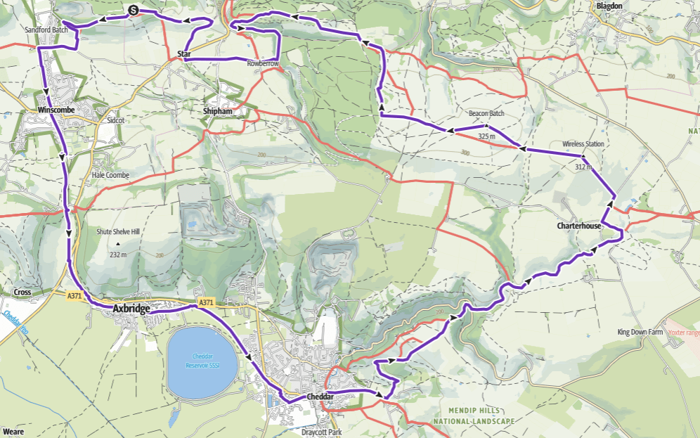
“West 31km”
31km with 800m ascent
This route covers the western section of the BTU50K and BTU50M courses, closing the loop going east on the Mendip Way after A38 then north at Shipham to return to Mendip Activity Centre.
GPX: Download here
Refreshments on this route:
Mendip Activity Centre at Churchill, our Race HQ with café/bar
The Queens Arms at Bleadon
“West 25km”
25km with 600m ascent
The same as West 31km route but cutting off the loop via Bleadon.
GPX: Download here
Refreshments on this route:
Mendip Activity Centre at Churchill, our Race HQ with café/bar
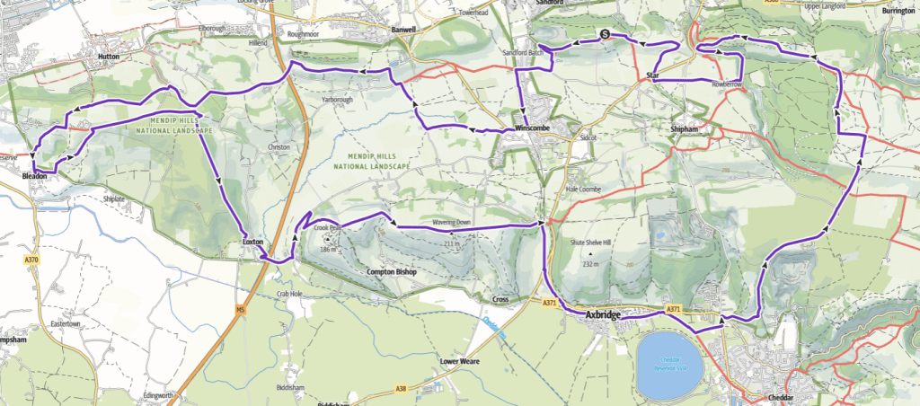
“East 30km”
30km with 600m ascent
This route covers the eastern section of the BTU50K and sections of the BTU50M from Axbridge to Cheddar and from Charterhouse to Winscombe.
GPX: Download here
Refreshments on this route:
Mendip Activity Centre at Churchill, our Race HQ with café/bar
The Lamb at Axbridge
The Swan at Rowberrow
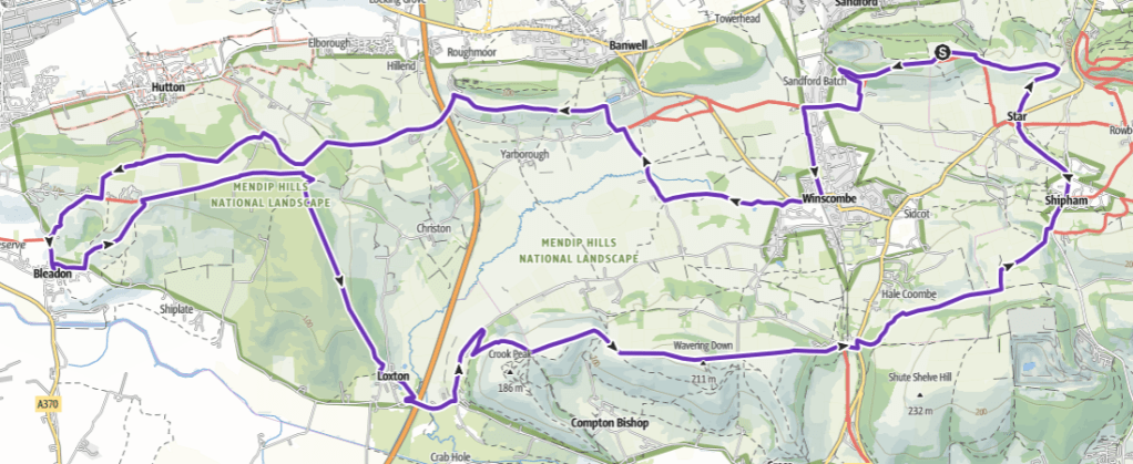
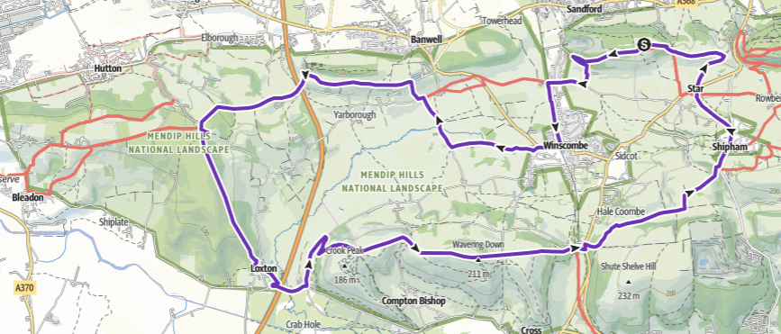
“West 42km”
42km with 1000m ascent
This route covers the full western section of the BTU50M, closing the loop by heading north at Cheddar to near Beacon Batch.
GPX: Download here
Refreshments on this route:
The Queens Arms at Bleadon
The Lamb at Axbridge
The Swan at Rowberrow
Mendip Activity Centre at Churchill, our Race HQ with café/bar
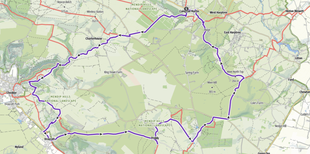
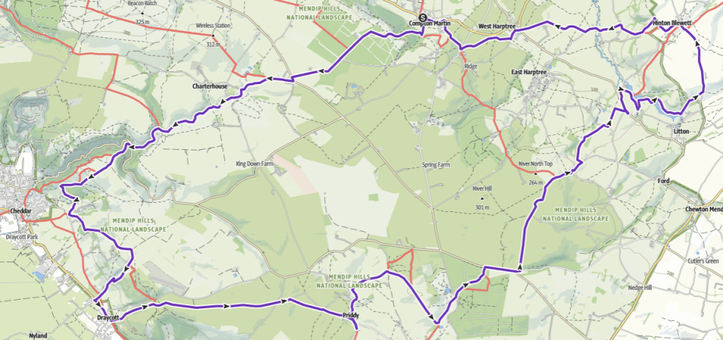
“East 41km”
41km with 800m ascent
This route covers the full eastern section of the BTU50M, closing the loop by cutting from Charterhouse back to Cheddar.
GPX: Download here
Refreshments on this route:
The Ring O’ Bells at Compton Martin
The Cider Barn at Draycott (café and bar, not just cider!)
The Queen Victoria at Priddy
“East 33km”
33km with 800m ascent
The same as East 41km route but cutting off the easternmost segment by heading north on the Monarch’s Way to the west of East Harptree.
GPX: Download here
Refreshments on this route:
The Ring O’ Bells at Compton Martin
The Cider Barn at Draycott (café and bar, not just cider!)
The Queen Victoria at Priddy